| |
|
| |
|
|
|
|
| |
|
| |
|
|
|
|
| |
|
| |
|
|
|
 |
 |
|
IMAGES ON FINGER FLOW
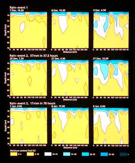
Figure 1. Unstable
wetting fronts leading to formation of preferred paths, resulting in
rapid transport to ground water. Soil has a memory and fingers follow
same path during different rainfalls. (Source:
Ritsema et al., 1998).
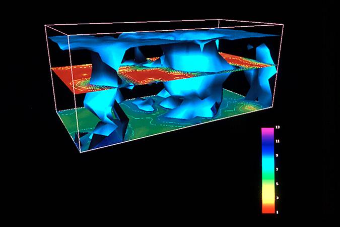
Figure 2. Spatial distribution of volumetric soil water content in the 60-cm-wide, 120-cm-long, 52-cm-deep water repellent sand block sampled in Ouddorp, Netherlands. The 8.5% soil water content isosurface and the intersecting horizontal cutting planes indicate that the vertical fingers started at the layer interface. Volumetric soil water content in the 9-cm-thick humic topsoil ranged from 12%-40%, while lower contents were found in the sandy subsoil (colored legend indicates water content scale). (Source: Ritsema et al., 1998).
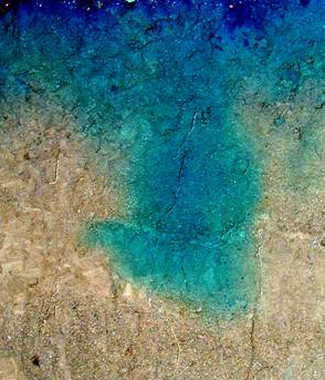
Figure 3. Distribution pattern of blue dye under unsaturated flow conditions in the undisturbed Arkport soil column after application of 2.5 cm dye solution at 0.2 cm/h. The dye wetted uniformly in the distribution zone with a depth of 5-10 cm. Below the distribution zone, a 10 cm wide finger formed that moved sligtly upward after it reached a coarse lens. (Source: Akthar et al., 2003)
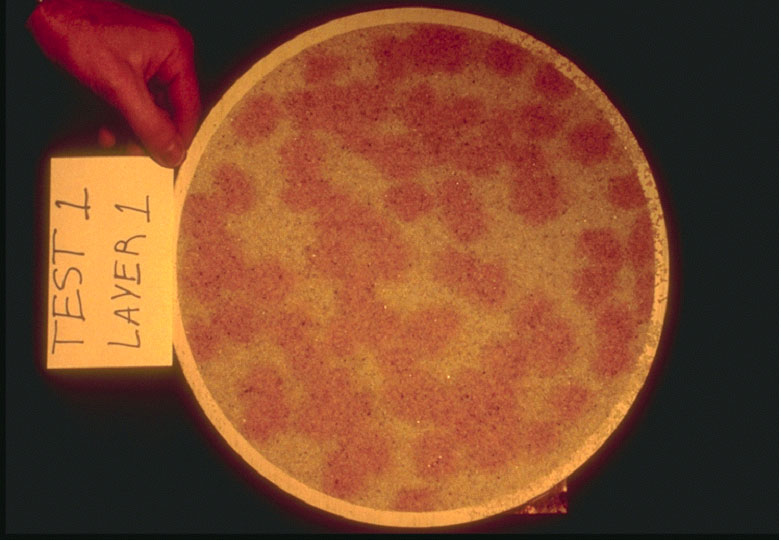
Figure 4. Fingers
(red) created in a homogeneous sand column (14 cm i.d., 50 cm high) at
14-cm depth (from the top) after rainfall rate of approximately 1.8 cm/h
was applied (Source: Soil and Water Lab, Cornell University)
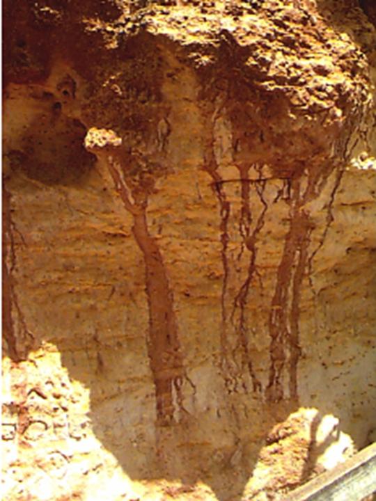
Figure 5. Formation of soil water fingers. Photo taken in Port Campbell National Park, 60 km east of Warrnambool, Australia. (Source: Stagnitti et al., 1998)
|
||||||||||||||||||||||