Categoricals detail
New York’s diverse and attractive physical and economic geography provide a rich array of settings where pesticide use and groundwater intersect. We maintain a thorough geographic database to aid in planning and interpretation.
This page provides second level detail about the variety of conditions in upstate New York that influenced where our categorical pesticide user cooperators are located. We are careful not to disclose directly or indirectly any individual cooperator, thus this is generalized rather than naming or hinting about any business.
1. Geology and ecological regions of NY
Almost all of New York was glaciated or strongly influenced by glaciers as they melted. The only exception is a small portion of the southwestern part of New York south of the Allegheny River, near Salamanca.
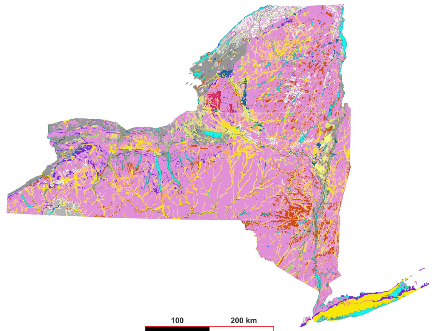
1.1 Surficial geology
The surficial aquifers we seek to measure are part of Upstate New York’s surficial geology pattern (Figure 1 below) which puts most of the more productive and extensive shallow aquifer land into river valleys. The distinction between yellow (sand and gravel primarily, alluvim and glacial outwash) and pink (higher clay content due to origin in glacial till) dominates. The extensive yellow part of Long Island (lower right corner) reflects that is is the most areally extensive and productive surficial aquifer system in New York. Gray represents lake silt and clay deposits primarily around the Great Lakes margins from when the lakes covered more of New York’s landscape as the glaciers melted.
1.2 Upper aquifers
The shallowest aquifers in upstate New York are considered the most valuable for water supply (if they are thick and extensive enough) and most vulnerable to contamination. These often occupy river valleys and consist mostly of sand and gravel deposits, alluvial and glacial. New York State’s official principal aquifer system, Figure 2, highlights the larger aquifers of this type for extra protection of groundwater recharge quality.

Yellow shading indicates aquifers that are unconsolidated and unconfined and are large enough to yield much drinking water.
When our pages and the DEC Division of Water mention vulnerability, this refers to the presumed likelihood of pesticide residues leaching vertically downward beyond the bottom of the root zone and toward the water table. This means no flow-restricting layers such as hardpans which will tend to make water move sideways rather than downwards, low organic matter since many pesticide sorb to organic matter, and deeper bedrock.
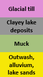
1.3 Federal ecological regions
“Ecological region” or ecoregion systems bring together landform, climate, and natural vegetation types to indicate differences in what crops people grow and why people may need pesticides. New York’s most extensive ecological regions (Figure 3) are the Allegheny and Eastern Great Lakes. The Northeastern Highlands region, Adrirondacks, Catskills, and Taconics, is also extensive, but sparsely populated because of much parkland and rugged building conditions. This region has low pesticide use intensity.
There are several systems of ecoregions. The ones by NYSDEC Division of Fish and Wildlife citing The Nature Conservancy are similar to the Federal regions. We use the federal ones because of more accessible documentation on internet.
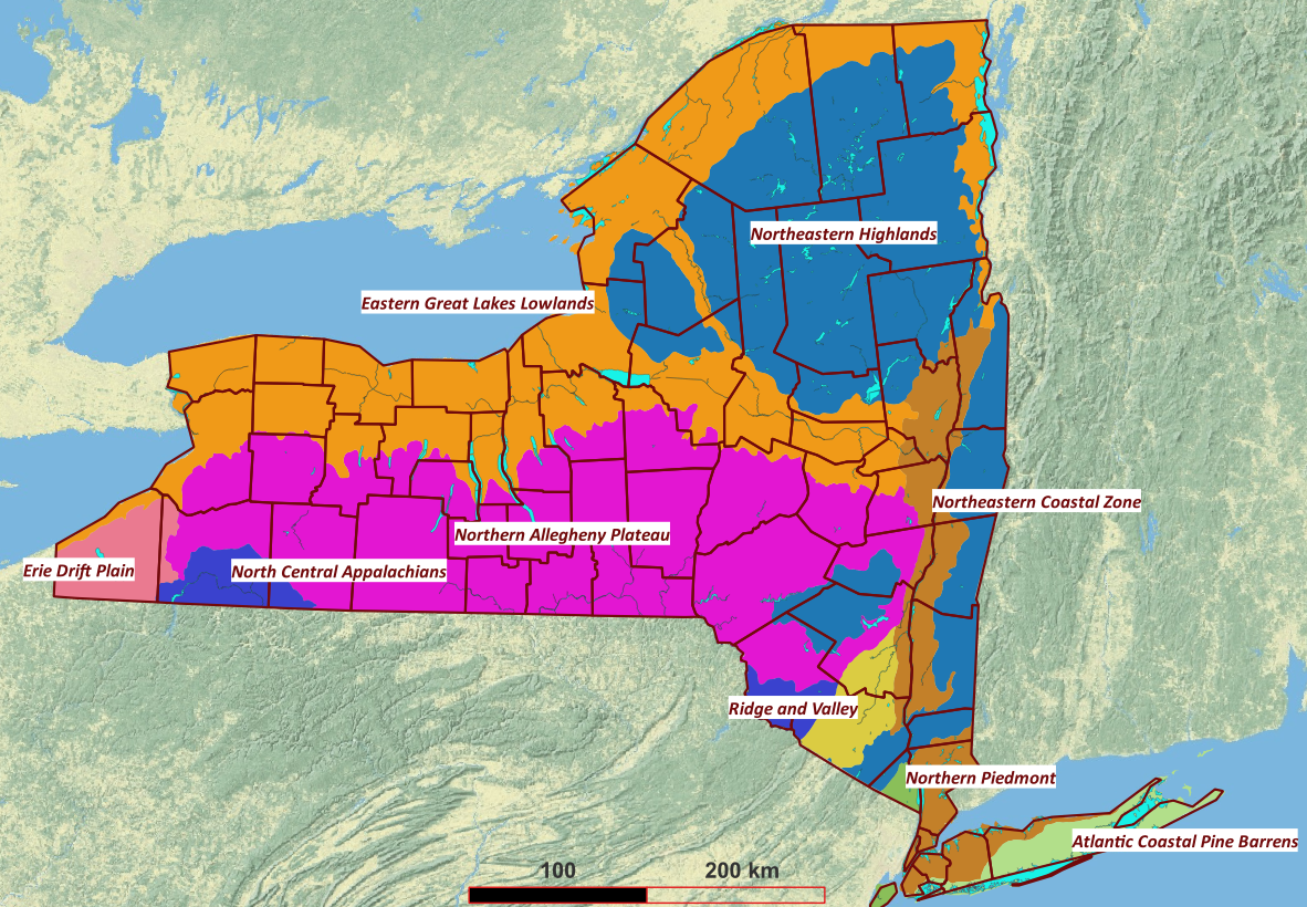
2. Where the pesticide user categories occur in upstate NY
We compiled maps of potential cooperators for several categories from Google Earth searches in 2021. Google Earth Pro allows searches like “vineyards near Seneca County, NY”, and presents the results in a way that can be copied to the clipboard in KML format, which is compatible with QGIS software. We ran around 50 consecutive searches for the upstate counties, appending the KML results then editing them into a single KML file for QGIS. Duplicates are removed, and false positives are removed.
The underlying data that Google Earth uses for these are public web pages of the businesses, which contain street addresses. Google then geocodes these to obtain latitude and longitude points.
Basemaps in this section are a hillshaded topographic image from the US Geological Survey.
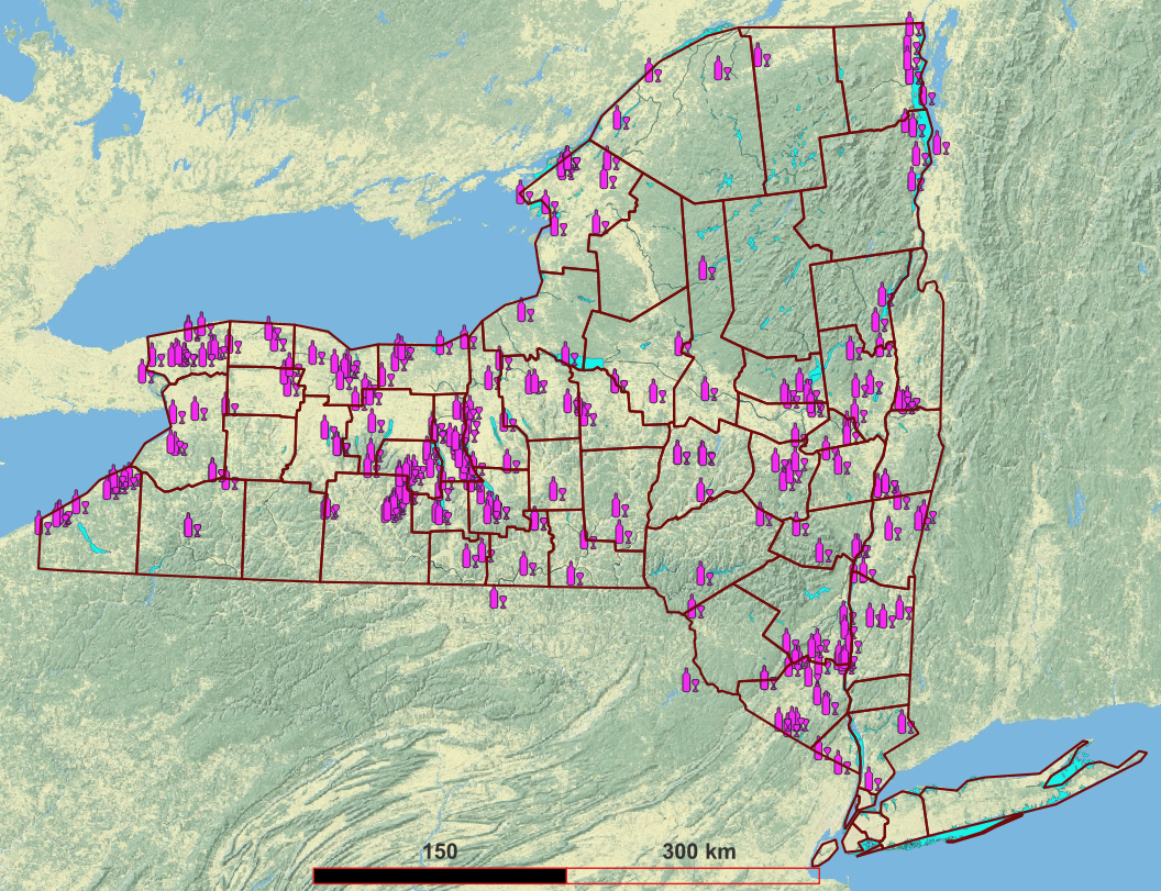
2.1 Golf courses
New York is the Empire State, but perhaps it should also be known as the golfer’s state. There are hundreds of golf courses in Upstate New York.
We have golf cooperators in the Ridge & Valley and Allegheny ecoregions. Two are in higher presumed vulnerability settings, and one in a presumed lower vulnerability setting.
2.2 Sod farms
There are around 10 sod farms in upstate New York, most of them occupying muckland. There is a concentration of several sod farms in Orange County’s Black Dirt (muckland) region.
Two sod farm owners agreed to be confidential cooperators, both using drained muckland (thus having presumed lower leaching vulnerability). The are in the Ridge and Valley and Great Lakes Lowland ecoregions.
2.3 Vineyards
New York is a major national producer of grapes for juice and wine. There are several registered American Viticultural Areas (AVA) in New York. Maps of the AVAs are downloadable from https://newyorkwines.org/wineries/ .
Google Earth searching for vineyards returns liquor stores which had to be deleted manually.
We have confidential cooperator vineyards in the Hudson River ecoregion, Finger Lakes, and Lake Erie AVAs. These fall into the Great Lakes, Allegheny, and Ridge and Valley ecoregions.
2.4 Fruit and Vegetable farms
Google Earth searching for these is complicated by the origins of such data: public web pages created by the businesses. A farm will be more specialized than “fruit” or “vegetable” thus more detailed terms like “orchard”, “berries”, and “pumpkins” are needed in searches. The map (Figure 7) is likely quite incomplete.
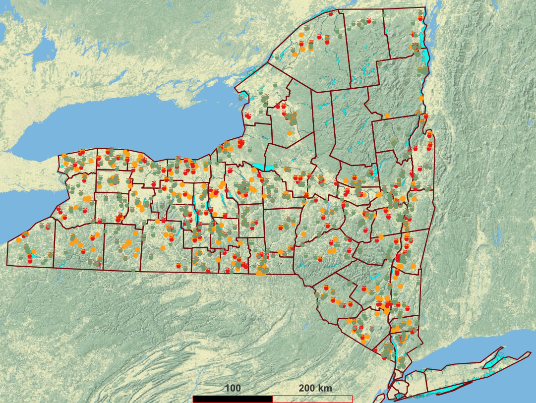
We have confidential vegetable and fruit cooperators in the Allegheny, Ridge and Valley, and Great Lakes Lowland ecoregions. One is a fruit farm, and two grow vegetables.
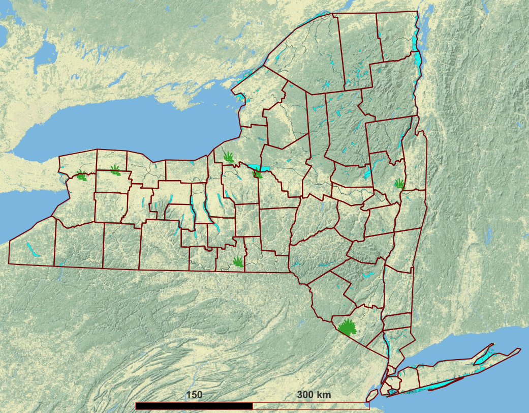
2.5 Outdoor nurseries
Google Earth searching for outdoor nurseries (Figure 8) finds child care facilities, which we delete.
We have confidential outdoor nursery cooperators in the Great Lakes, Allegheny, and Highlands ecoregions. One specializes in grasses and is entirely outdoors. One specializes in woody plants. One has shrubs and trees.
2.6 Greenhouses
Greenhouses come in all sizes, from single units to dozens of units that nearly completely cover a lot. Some can open their entire greenhouse to the air, others have permanently enclosed glass, and others have a mixture. They are also incredibly diverse in what they grow inside. There must be several hundred “garden center” operations that include a few greenhouses open for retail browsing. Some greenhouses grow from seeds, others bring in potted plants that another (wholesale) greenhouse has started off.

We have confidential cooperating greenhouses in the Coastal (Hudson) and Allegheny ecoregions. The three sites are all seasonal retail operations, who do not maintain plants during the winter. They sell vegetable, fruit, and ornamental plants.
This category overlaps with “outdoor nursery” quite a bit; the two displayed maps have many sites in common. Two of our three outdoor nursery cooperators have greenhouses on premises. One of the nurseries has the mixture of permanently enclosed space and space that removes a plastic cover during the growing season.
We assigned this indoor+outdoor nurseries to one or the other category, depending on the larger groundwater influence.
- Site Green-18 is a garden center with four greenhouses, and we measure its groundwater quality as mostly affected by indoor plant management by where we placed temporary wells. The owner keeps many plants outdoors from spring through fall.
- Site Nur-3 has a few all-year covered greenhouses and several more greenhouses whose covering is removed during the growing season. All plants are inside greenhouse footprints. Water leaving these open and closed greenhouses infiltrates into a shallow aquifer on property where we installed two wells. Thus we measure the net residues from indoor plus outdoor pesticide uses.
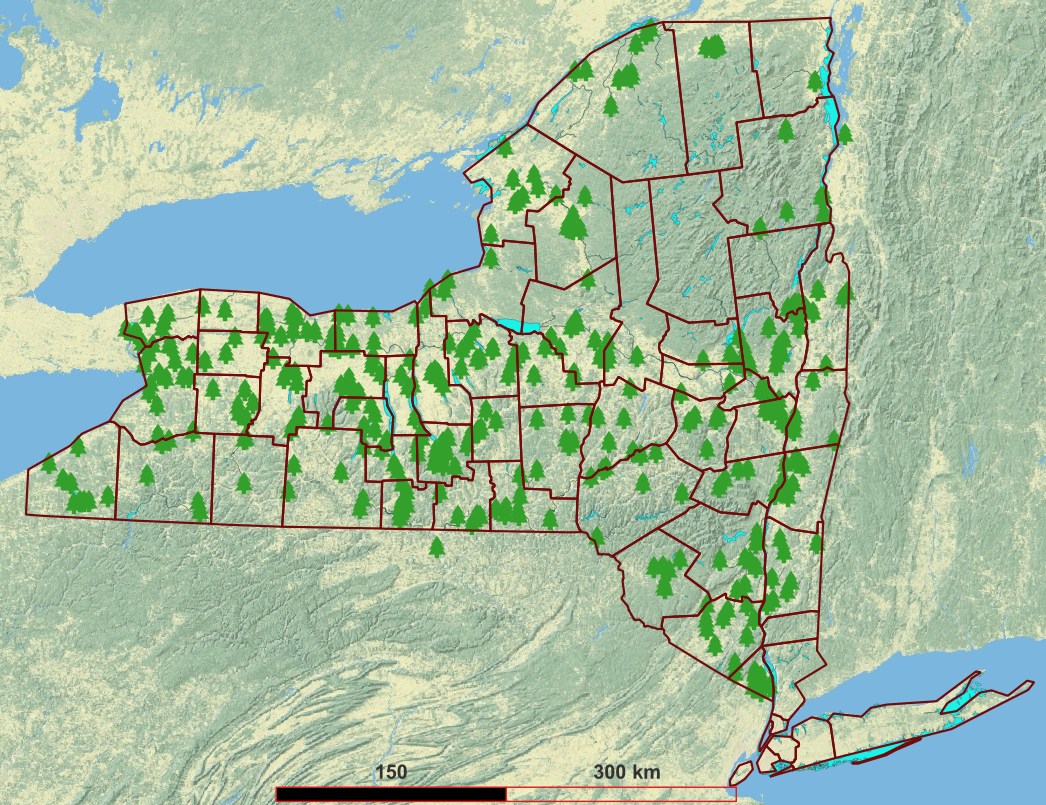
2.7 Utility and transportation rights of way
Even though heyday of rail in New York is long past, there are still many kilometers of active track (Figure 10).
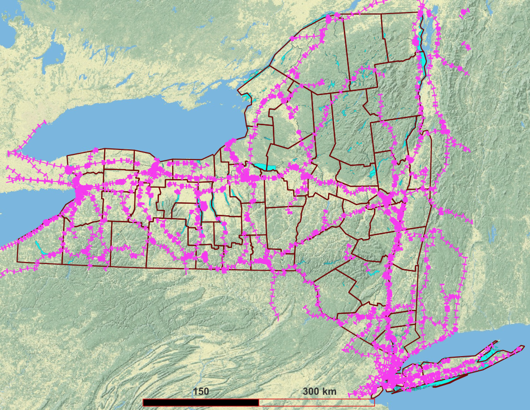
Major power lines and some other critical infrastructure cannot be shown on public maps after the terrorist attacks of September 11, 2001.
2.8 “Residential and institutional turf”
There are hundreds of thousands of potential properties in this category, with a tremendous diversity from zero pesticide use to elaborate garden maintenance. Most of them are tiny residential lots. There is no way to map these productively.
We recruited one owner of residential condominium properties associated with a multi-faceted resort, using their irrigation well downgradient from the residential area.
We decided after multiple failures to recruit institutional sites (such as a college and a museum), which often have multi-layer bureaucracies, that we would settle for a single site in this category.
2.9 Multicategory sites
We have three sites whose property matches two distinct categories and we have two sets of wells installed or adopted.
Property Vine-4 has a power line passing over it, thus we installed an extra well to represent ROW-1. The ROW-1 operator has an easement on Vine-4 property; ROW-1 reports when it uses pesticides to the Vine-4 owner. The ROW-1 area is at the downgradient edge of the Vine-4 vineyard fields, thus the ROW-1 well will be influenced by both the utility management and the vineyard.
Property Nur-2 has a railway corridor passing through it, thus we installed upgradient and downgradient wells on Nur-2 land to measure upgradient and downgradient conditions of ROW-2. The upgradient well for ROW-2 is also downgradient for part of the Nur-2 property, and the two downgradient wells for ROW-2 are upgradient from Nur-2 property.
Property Golf-7 is part of a multi-season resort and has condominium residences at their property, thus we also have Turf-1 with its own well downgradient from the condominium area. The Turf-1 well is unlikely to be influenced by the main golf course due to groundwater flow directions.
3. Correlations among categories and landscapes
3.1 Sod and muckland
From discussion with one cooperating sod farm owner, sod farms have a strong affinity for muckland because of the ability to slice off a thin layer of grass with roots but still retain soil (when the muck is thick), and also the resulting sod slice is lightweight for transportation. This strong connection means that:
- To represent sod we absolutely need muck farms, even though this land is presumed low vulnerability to leaching.
- Since muck is presumed low vulnerability to leaching most pesticides due to the very high organic matter content, it would be difficult to find sod farms with presumed high vulnerability.
3.2 Golf and valleys
From map overlay and reconnaissance, golf courses tend to be in valley bottoms, thus matching more leaching-vulnerable aquifers than if they were randomly distributed.
There were many upstate golf courses that would have higher presumed vulnerability terrain.
3.3 Greenhouses and valleys
From map overlay and reconnaissance, greenhouses are more likely than not to be in valley bottoms (where population is denser), thus matching more leaching-vulnerable aquifers than if they were randomly distributed. (Greenhouses are less correlated with valley bottoms than golf courses.)
Our initial outreach to greenhouses yielded may “organic” ones. Since they are not pesticide users, they are not relevant to the project’s categorical type; however if their neighbors use pesticides they could be a relevant long term site.
3.4 Vineyards and sloping lands
From map overlay and discussion with viticultural faculty and vineyard owners, vines tend to be planted on sloping land rather than flat land. Thus they are tending to be on glacial till soils more than alluvium and outwash, thus tending to have low to medium presumed leaching vulnerability.
Of the three vineyards agreeing to participate, one has an unusual glacial outwash fan under part of their vine fields, one has an ancient gravelly beach ridge, and the third has a mix of outwash and till. One test well at the third vineyard had a several foot thick saturated clay layer protecting the gravel aquifer underneath, and the other test well had free vertical drainage to over 5 meters.
Last updated: 2023-08-13, sp17 AT cornell.edu
Footnotes
New York State Museum. 1986. Surficial Geologic Map of New York. URL: https://www.nysm.nysed.gov/staff-publications/surficial-geologic-map-new-york↩︎
New York State Department of Environmental Conservation, Division of Water. 1990. Primary and Principal Aquifer Determinations. URL: https://www.dec.ny.gov/docs/water_pdf/togs213.pdf↩︎
US Environmental Protection Agency. Various dates. Ecoregions. New York downloads at: https://www.epa.gov/eco-research/ecoregion-download-files-state-region-2#pane-30 . Also see: Omernik, J.M. and G.E. Griffith. 2014. Ecoregions of the conterminous United States: evolution of a hierarchical spatial framework. Environmental Management 54(6):1249-1266. DOI: https://doi.org/10.1007/s00267-014-0364-1↩︎
Google Earth Pro search results captures in KML format, various dates in 2021. How to cite Google Earth results: https://about.google/brand-resource-center/products-and-services/geo-guidelines/#:~:text=Google%20Earth%20or%20Earth%20Studio%20can%20be%20used%20for%20purposes,any%20commercial%20or%20promotional%20purposes.↩︎
Source: US Census 2000 TIGER. URL: https://www.census.gov/geographies/mapping-files/time-series/geo/tiger-line-file.html.↩︎