graph TD;
   DEClab(("NYSDEC<br>Air<br>lab"));
   SWL(("Cornell<br>SWL"));
   DEClab-->SWL;
   SWL-->DEClab;
   DECpest(("NYSDEC<br>Bureau of Pest<br>Management"));
   DECpest-->SWL;
   SWL-->DECpest;
   Owners(("Cooperating<br>landowners<br>with wells"));
   Owners-->SWL;
   SWL-->Owners;
   DECpest-->DEClab;
   Lakers(("Lake<br>volunteers"));
   Lakers-->SWL;
   SWL-->Lakers;
DEC groundwater pesticides QAPP main page
Priority: medium
Updating: static
This Page, also called the QAPP outline, provides overall structure and linkage to the collection of HowTo Pages that constitute the project’s operating guidance. This Page is in a format closely related to the US EPA recommended outline for Quality Assurance Project Plans. The HowTo pages are structured similarly to US EPA’s recommendations for Standard Operating Procedure documents.
The “live” online version of this is currently experimental and unpublished, but we indent for the entire collection to be online as part of the Soil and Water Lab’s website.
Change log for the DEC groundwater pesticides QAPP outline page:
| When | Who | Comment |
|---|---|---|
| 2021 03 09 | sp17 | First version |
| 2021 03 13 | Sp17 | Inserted graphs composed with the dot language (later changed to Mermaid) |
| 2021 03 18 | Sp17 | Tightening this page as an index to the HowTos. This page is the “glue” among the documentation. |
| 2021 07 29 | Sp17 | Resumed filling this in. This includes linking to the detailed HOWTO pages. |
| 2021 09 08 | Sp17 | More infilling. Concentrating today on project objectives, data quality objectives, and assessment. |
| 2021 09 10 | Sp17 | Factor in discussion from meeting this week: What our data quality objectives are and how to assess how well we have met them. |
| 2021 09 12 | Sp17 | Filled in most missing materials. Circulated to Tammo, Brian, Naaran for comment. |
| 2021 10 01 | Sp17 | Minor editing to work in MS Word export format. Deleted most links to lakes material since there are too few samples (8 per year) for formal data quality planning. There are HowTo pages for lakes for reference, not considered part of the reviewable QAPP. This was submitted to NYSDEC with a quarterly progress report. |
| 2023 06 04 | Sp17 | Cumulative update including external web links. Made QAPP section into its own OneNote notebook to facilitate a fresh DEC review. The review format in this case is a MS Word export of this page which contains links to OneNote online. There have been no substantive changes in this component, including in its data quality targets and general approaches, since October 2021. Many HowTo components have been added and updated since then. |
| 2023 06 21 | Sp17 | Converted to Markdown; Microsoft OneNote proved to be too proprietary for sharing with NYSDEC, within the Cornell work group, or with the public. Declared 100% complete, though always subject to comments and improvement. |
| 2023 08 01 | Sp17 | Numbered the figures. |
| 2023 09 27 | Sp17 | Updated web links to earlier SWL+NYSDEC joint projects. |
Headnote: The US EPA specified template for a QAPP includes a signature page; there are no separate formal approvals of this material thus signatures do not apply. NYSDEC Bureau of Pest Management oversees all activity by Cornell University via a contract with annual scope of work approvals and quarterly payment requests which include progress reports. The DEC Air Lab’s involvement is negotiated between the Bureau and Lab via an interdivisional process.
1. Project Management
1.1 Title and approvals
Title: Quality Assurance Project Plan (QAPP) for New York State Department of Environmental Conservation (NYSDEC) Upstate New York Pesticides in Groundwater Project, 2021-2025
As carried out by:
Cornell University, Department of Biological and Environmental Engineering, Soil and Water Lab (“Cornell SWL” or “SWL”) and by NYSDEC Air Lab
under supervision of
NYSDEC Bureau of Pest Management
Key personnel involved: Cornell SWL:
- Tamme S. Steenhuis, Professor, Lead Principal Investigator
- Brian K. Richards, Second Principal Investigator
NYSDEC Air lab:
- Christine Van Patten
NYSDEC Bureau of Pest Management:
- Scott Menrath - Bureau Director
- Jeanine Broughel - Section Chief
- Jim Carpentier - Project Officer for contract
- Leili Vogl - Geologist
Comments on this Plan are welcome from all directly or indirectly involved at any time; please email to maintainer Steven Pacenka sp17 AT cornell.edu; please cite the Page title and section heading number being commented upon. There are change logs in all pages indicating when a comment was addressed; please also cite the most recent date from the change long of a page when commenting.
1.2 Contents
The contents of this QAPP Collection are the heading and subheading structure of this page and the all-pages index which refers to all HowTo pages. The all-pages index allows hypertext jumps besides the jumps embedded in the text of this page. The page contents allow jumps from section to section within the page. There are also hypertext cross-links between different HowTo pages and this QAPP Outline page.
The HowTo pages are similar in role to what US EPA calls “standard operating procedures” for more intricate technical steps of the project.
1.3 Distribution list
This page collection (QAPP Outline plus HowTo pages) is shared online only. It is “distributed” whenever someone goes to read it.
The online version will be refreshed periodically. The “source code” for the pages is updated frequently in small ways, and will be slightly “ahead” of the version visible to the public and NYSDEC on the web.
1.4 Project organization
Key people as of 2023 06 14: Cornell University, Soil and Water Lab:
- Tamme S. Steenhuis. Professor, Principal investigator, Email: tss1@cornell.edu
- Brian K. Richards, Senior Research Associate, co-principal investigator, and Project manager. Email: bkr2@cornell.edu
New York State Department of Environmental Conservation:
- Jim Carpentier: NYSDEC Bureau of Pest Management, contract officer.
- Christine Van Patten : NYSDEC Division of Air Lab
Steven Pacenka, Research Support Specialist of SWL is Quality Assurance contact and maintainer of this documentation set. sp17@cornell.edu, and is a primary project implementer.
Generally, Cornell SWL is the project hub for communications and the flow of water samples between the field and the lab. The cooperating landowners are deliberately insulated from the DEC participants unless the cooperator elects to waive their anonymity and confidentiality. This is to give the cooperator confidence that they may be fully open in communication with Cornell SWL for the project without affecting their regulatory relationship with NYSDEC or their privacy. NYSDEC and Cornell SWL are grateful for the owners’ anonymous involvement or disclosed involvement.
Lake Association sampling volunteers are less formally involved, on a small scale, and are not considered confidential partners. Cornell SWL will provide their project-specific technical support and will be the lake volunteers’ most frequent project contact. NYSDEC is grateful for the lake volunteer involvement.
1.5 Background
See also the original contract scope of work. The scope has been revised informally from the original to improve feasibility and efficiency. The HowTos in particular supersede many details of the original scope.
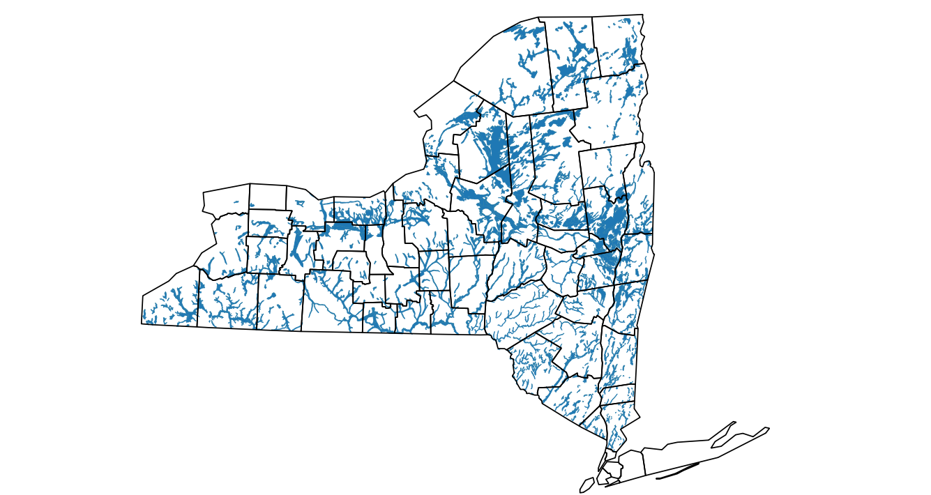
Upstate New York (State excluding Long Island and New York City) has highly diverse soil, climate, geology, and economic patterns that pose a broad challenge for ensuring the safe use of pesticides.
Included in the challenge is groundwater monitoring. New York has done limited monitoring of upstate groundwater quality. Exceptions include hazardous waste sites and public water supply wells. The limited monitoring means that pesticide use label rates and timings, often extrapolated from other areas, must be assumed to be adequately protective while not being too restrictive of beneficial economic uses.
Cornell SWL and NYSDEC Bureau of Pest Management limited monitoring since 2001 has focused mostly on field crop herbicides. Such work has not found exceedances of drinking water or ecological concentration criteria. However the diversity of other pesticides and their uses in diverse contexts, require empirical groundwater monitoring to ensure that model assumptions are sufficiently protective. This project provides such an attempt relying upon volunteer pesticide users, volunteer well owners, and volunteer lake enthusiasts.
1.5.1 Purpose and
1.5.2 Value of the project
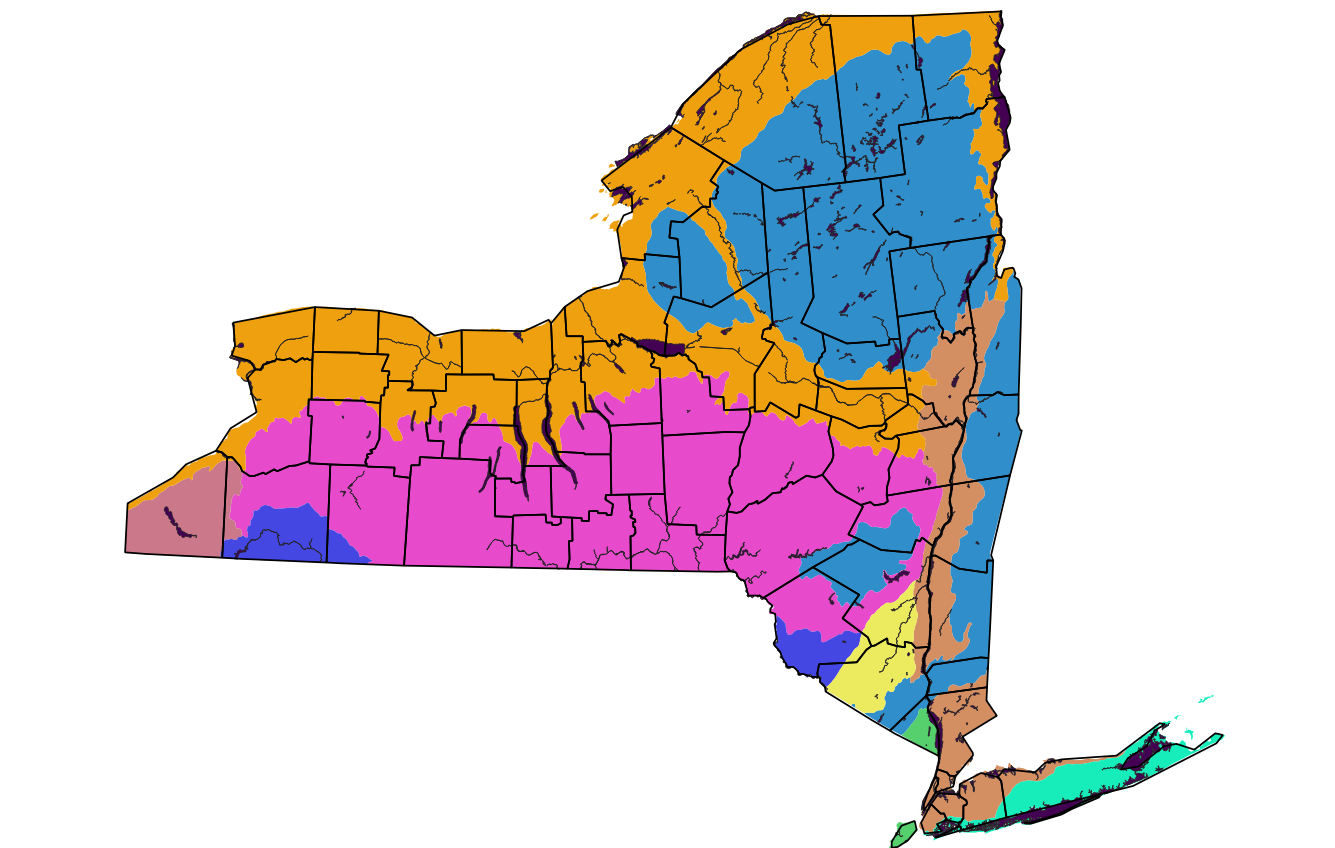
In pesticide regulation, New York has been assuming that pesticide label provisions for Long Island, with its very sensitive groundwater system and high pesticide use, are conservative from environmental and human health perspectives in upstate New York. However, the geographic diversity of upstate New York’s combinations of factors that affect the fate of pesticides is much greater than Long Island’s geographic diversity. It cannot be ruled out that certain conditions upstate are “worse” than Long Island’s.
As the clearest example, Long Island does not contain any Karst terrain. Upstate New York has distinctive Karst areas where water quality in wells changes rapidly in response to water quality in streams that lose their flow to groundwater. There are also buried sinkholes that provide a rapid injection point for overland runoff. Earlier work in the Cornell contracts with NYSDEC included a special monitoring project focused on tightly linked surface and groundwater systems and confirmed that wells in Kast terrain are highly sensitive. The use of these aquifers for drinking water is relatively low and New York State does not assign them a high priority; New York prioritizes unconsolidated, unconfined aquifers.

(Map excerpted from statewide geology map published by NYS Geologist.)
The project’s objectives, stated as questions, correspond with the project’s two kinds of groundwater monitoring:
Project objective Categorical: Close-up monitoring of leaching of pesticides from 24 users spread across eight categories. Nominal 144 samples/year.
- Are there label-compliant categorical pesticide uses and contexts among the diversity of upstate New York that can lead to pesticide concentrations of concern in groundwater very near usage sites?
Project objective Long term: Area monitoring of occurrence of pesticides in ground water downgradient from mixed pesticide uses. Nominal 24 samples/year.
- Are there area uses of pesticides in specific use contexts among the diversity of upstate New York that lead to concentrations of concern in groundwater downgradient from them?
These questions are formulated across all sites of the type and stress ranges of exploration. We will recruit across partial spectra of diversity in pesticide use intensity, aquifer vulnerability, and regional water balance tendencies and are most interested in situations that differ from the Long Island combinations. This is an attempt to maximize insights possible from a modest number of samples from volunteer sites per year.
The primary reference criteria (“concentrations of concern”) to compare the data against are the ensemble of health and ecological water quality criteria used by New York State. The Division of Water maintains a TOGS document numbered 111 that compiles official groundwater criteria. Online link: Division of Water Technical and Operational Guidance Series 1.1.1 (ny.gov).
This project includes the State’s mapped principal aquifer system as one of the most important inputs to pesticide monitoring upstate.
Map by USGS and reflecting NYSDEC Division of Water criteria. See: Division of Water Technical and Operational Guidance Series (2.1.3.): Primary and Principal Aquifer Determinations. (1990)
The project’s lake sampling – at a nominal eight samples per year – is too small to merit formal consideration in a QAPP. Nevertheless, there are HowTo’s that guide and document the lake watershed characterization, lake sampling and sample handling activities.
1.5.3 Who are the data users?
There are four classes of intended data users:
- NYSDEC Bureau of Pest Management, as advised by Cornell SWL: all data as censored to protect individual property owner privacy and confidentiality. This is the governing perspective for evaluating the ensemble of sites selected and their collective results.
- Individual confidential cooperating site (categorical and long term) owners: data from their own site, uncensored. This is a recruiting incentive at least for the long term site owners. This is the governing perspective for individual site and sample confidence.
- Future NYS DEC users of the project water quality data via EQuIS: subset of data from all sites, anonymized and greatly blurred locations. These data users and their purposes are unknown, thus EQuIS standards are the only indication of how to provide for them. This is a low priority perspective.
- Cornell University SWL: in-service training for certified pesticide applicators. We interpret the uncensored data for the particular training use, taking care not leak identities. This is a low priority perspective.
- General public and scientific community. We intend to publish general findings in several forms including peer reviewed journals to provide additional scrutiny and possibly create additional respect for the results.
Cornell SWL provides the cooperating site owners with explanations and interpretations of results annually, along with full measurement data.
The anonymized data reaching the Bureau of Pest Management also need additional Cornell interpretations to compensate for not being able to disclose exact locations. The intended data uses do not require disclosure of exact locations to NYSDEC or the public.
The EQuIS users have contact information for Cornell as data submitters as part of the metadata, and the DEC Air lab analytical data are attributed to that lab. Geographic locations will be heavily blurred for most of the categorical sites, unless they decide to “go public.” Data from long term sites may have blurring to their zip code centroid.
1.5.4 Prior and ongoing data
Long Island of New York, which is being monitored by another project with similar intentions, has had extensive well contamination by routine use of a few pesticides in the past (starting in mid 1970s), which led to a major shift in manufacturer and agency regulatory approach there and triggered very extensive monitoring in several US regions. Long Island’s own monitoring began to include close-up monitoring of individual pesticide users after 2000; this and other very extensive monitoring data from the Suffolk County Department of Health Services have been factored into tightened pollution prevention strategies.
There are effectively no data in Upstate NY for groundwater quality close to label-compliant pesticide use areas, except that which is incidental to an earlier monitoring set in this series that focused on private drinking water wells.
There is no ongoing pesticide concentration data in Upstate NY from private drinking water wells. This project’s “long term” wells task restarts an older series of county-oriented monitoring that spanned roughly 240 samples then revisited selected wells having higher initial concentrations. It did not reveal obvious needs for revisions to pesticide labels. Those data are in NYSDEC’s EQUIS.
Most of the Cornell/DEC monitored sites were near “field crop” (mostly feed for livestock) areas thus the analyte list stressed field crop herbicides and their breakdown products (metabolites). USGS stream baseflow monitoring, Cornell/NYSDEC private well monitoring, and Volunteer/Cornell/NYSDEC monitoring at one lake with an agricultural watershed found frequent low level residues of field crop herbicides and their metabolites. There were occasional, brief excursions above the 3 µg/L drinking water criterion for atrazine in USGS targeted stormflow monitoring (skip to page 395). We are not aware of any upstate public water supply wells having pesticide or metabolite concentrations of concern.
There is ongoing pesticide data from surface water monitoring in NYSDEC’s Rotating Intensive Basin Studies (RIBS) program. There are a few project data sets for lakes from earlier Cornell SWL + Bureau of Pest Management work.
1.5.5 Data gaps
Our earlier ~240 well effort in six counties, with selective resampling in five counties, spanned higher pesticide intensity counties, also focusing toward more leachable chemicals. We overlaid pesticide use and sales weighted for USDA’s ground water ubiquity score to decide which counties to target, which slanted us toward the Lake Ontario region after a foray into Orange County.
The larger upstate NY data gaps for pesticides in groundwater are:
- pesticides other than those used on field crops; earlier analyte lists were slanted toward field crop herbicides and their metabolites.
- groundwater beneath more site-intense pesticide users; sampling was mostly from potable wells which tend toward locations not intimate with a pesticide using facility like a greenhouse;
- groundwater from principal aquifers (most sensitive economically significant ones) which tend not to be common in the geographic region emphasized in later rounds (Genesee, Wayne, Cayuga, Orange counties).
1.6 Tasks and schedule
The project lasts from January 1, 2021 through December 31, 2025. It is not necessarily closed-ended. Contract workplans are updated annually. See the workplans for all schedule details.
In the ramp-up years 2021 and 2022 the schedule is dominated by preparation and negotiation of volunteer site acquisition. The project slowly transitions from acquisition to routine operation as sites agree to participate and any onsite monitoring installation is completed.
Both acquisition and operation phases are dominated by 24 “categorical” pesticide user sites, which will have 24 independent schedules. More than 24 will be approached for potential involvement because some discussions will not yield an operating site nor will there be universal willingness. For a site that does become operational, there is a sequence of interactions that proceeds from nomination as potential, taking a sounding by phone, Cornell visiting for an interview and walkaround, site characterization to select monitoring locations, initial sampling of existing wells, installation of new monitor wells where necessary, and routine seasonal sampling. Analytical data begin to flow as a site reaches the “initial sampling” step. (Field measurements are available immediately; laboratory analytical results depend on the lab’s work queue.)
Tasks to get a site from possibility to initial yielder of data are contained in HowTo pages about recruiting (framework), site characterization, and monitor well installation. Tasks to operate the site are contained in HowTo pages about preparing for sampling trips, sampling from monitor wells and from owner wells, processing samples brought back to Cornell, storing samples, and shipping sample aliquots to DEC’s Air lab.
1.7 Quality objectives and criteria for new measurement data
1.7.1 General data quality considerations
The project’s highest priority data uses are on the level of strategy, reconnaissance, and overview. The project’s data do not have to withstand regulatory or law enforcement scrutiny, particularly not at the individual parameter, sample, or well/lake level. Generally anything discovered in an individual sample that raises a health or ecological concern requires resampling and retesting; resampling protocol is part of the QAPP HowTos (aspect not written up as of 2023 06 01, since there have been no concentrations of concern in prior projects or the current project).
The deliberate breadth first approach comes at the expense of depth. This limits the precision and accuracy of information content at individual sites and must keep most emphasis on the patterns across the 24+24 well sites.
From a DEC perspective beyond the project, particularly reuse via EQUIS, this project should provide well documented data so that the strengths and weaknesses are evident to data reusers.
The DEC Air Lab’s data are generally of forensics-grade quality and this project’s data are undemanding of their talents and equipment. To do justice to this laboratory’s rigor, we will ensure that the samples they receive properly represent the state of the system being sampled when sampled. No other aspects of this project will be forensics grade.
Cornell is obligated to the confidentially cooperating well owners to be thorough and careful in site characterization, well selection or installation, sampling, sample protection, and analytical chemistry. The owners also do not rely on high precision but high or low biases can be important. A safeguard of this data use is that samples which yield concentrations approaching or above levels of concern will have early follow-up sampling to confirm them.
1.7.2 Specific data quality objectives
1.5.3 in this outline provides perspectives and priorities among various data users. For the NYSDEC Bureau of Pest Management’s perspective, diversity of pesticide rates and contexts is the most important metric. We will strive for categorical sites to be diverse across several factors:
- There must be diversity of user category (eight categories), ecoregionality (up to eight ecoregions), and sensitivity of site soils and aquifers (from somewhat sensitive to most sensitive).
- Guideline: three of each of the eight categories; will consider fewer in some categories when possibilities are scarce or voluntarism has been poor.
- Guideline: spread within the category across two or more ecoregions
- Guideline: spread within the category across multiple aquifer vulnerabilities
- Guideline: one-fifth of the sites in lower vulnerability settings and four-fifths in average to high vulnerability settings. Avoid the lowest vulnerability: confined aquifers, very low yield areas, lake clay surficial geology, and similar low recharge areas.
- Guideline: have some sites in each of the eight ecoregions.

References: https://www.epa.gov/eco-research/ecoregions, https://www.epa.gov/eco-research/ecoregion-download-files-state-region-2#pane-30
For the long-term sites, we will also strive for diversity of ecoregions, varied upgradient aquifer vulnerabilities (slanting toward more vulnerable but not omitting less vulnerable), and pesticide intensity (inclined toward the upper half of PSUR-reported spatial intensities for selected popular pesticides).
We accumulate data and metadata for later assessment in tracking tables that provide each site’s attributes for each dimension. This will be part of periodic status reporting from Cornell to NYSDEC. (The tracking tables themselves are confidential, excerpts carefully avoid direct and indirect disclosure of confidential cooperator identity and detailed location.)
For both the DEC Bureau of Pest Management and the site owners, we will strive for integrity of individual samples and analytical data: - Sufficient understanding of local groundwater flow to attribute land uses and pesticide uses to downgradient and upgradient wells correctly; (professional judgment by Cornell SWL and land owner insights) - Proper well installation (categorical sites only), proper sampling technique, proper preservation and storage of samples, and proper analytical techniques in field and lab.
The applicable definitions of “sufficient” and “proper” are contained in individual HowTo pages. Paper field and lab logs (specified in two more HowTo pages) are important recordkeeping tools for later review of how well the project lived up to “proper”.
1.7.3 EQUIS data reuse considerations
EQUIS submission is mandated for all NYSDEC-related water quality monitoring activities. - We must keep up with EQUIS requirements (Environmental Data Submission - NYS Dept. of Environmental Conservation), which evolve.
- Items from the EQuIS perspective that need resolution for this project specifically:
- Analytes or analytical methods not yet in the registered EQUIS list: we can submit requests. Note that we must live with any prior, equivalent name and description of the analyte or method. If our method is different we must register a new analyte name and the variant method.
- We had been using a simplified alternative format for earlier EQuIS submissions. Does this continue to be the correct approach?
- How best to include the DEC Air lab’s spike recovery test and other quality control results?
- Is marking lesser quality data as “screening” the appropriate way to flag results not produced in certified labs, or field results involving inexperienced personnel? Is there a more fine grained way to encode warnings about data quality than screening versus normal?
EQuIS reuse mandates are not central to the project, but still they require more elaborate documentation and metadata than the project itself.
1.8 Training requirements and certifications
The project does not have contract-mandated training requirements or certifications.
Field safety: It is advisable for project personnel involved in field sample collection to have pesticide safety training because they may visit sites for sampling a short time after pesticides were applied. In particular, for the Categorical sites where some wells may be close to pesticide use areas, the sampling personnel should be literate about the pesticide product labels for any products used recently at the site. The sampling personnel thus will need to be in rapport with the site owners to know which products are being used. We closely collaborate with Cornell’s Pesticide Safety Education Program staff who are also under contract with the NYSDEC Bureau of Pest Management.
Any volunteer lake samplers will have been trained by peers and DEC Division of Water personnel about how to collect samples from a specific depth range.
1.9 Documents and records
Nearly all project records are electronic and created at Cornell.
Project records at Cornell will include at least:
This QAPP Outline and related HowTos, maintained by Cornell.
Sample tracking data and analytical process details are retained by the DEC Air Lab following their documented procedures. While Cornell and the DEC Air lab remain very close collaborators, we treat the DEC Air lab as semi-external to the project; Cornell sends samples and gets back data. The lab’s handling of samples is mostly opaque to Cornell.
Cornell creates periodic excerpts of incremental project data (including analytical and QC results from DEC’s Air Lab) in Microsoft Excel and submits these into the DEC EQUIS review process. There is also a mechanism to correct earlier erroneous data. Those data enter custody of another unit of DEC that is not part of this project.
- To facilitate this, Cornell SWL maintains a cumulative tabular tabular database of sampling site, samples, and analytical results designed around eventual EQUIS submissions and for reporting to cooperators and the Bureau of Pest Management.
- Cornell SWL does not control the importing of data into EQUIS, and does not have a means to check if the data in EQUIS match what we submitted.
The only transmitted laboratory analytical data report is from the DEC Air lab to Cornell, generally one report per batch of samples sent from Cornell and using Cornell’s sample IDs as well as the lab’s internal sample ID’s. These reports also go to the Bureau of Pesticides. Data of this type have been emailed to Cornell via attached files (PDF or Excel spreadsheet). Any added Cornell data are considered context for the formal DEC lab results, for example depths to water in wells, conductance, temperature, pH during sampling.
Geographic database at upstate-wide and site levels of detail. This is maintained in “the cloud” (encrypted) for easy sharing across Cornell project personnel. Some of the data are confidential between Cornell and site owners, some are sharable to NYsDEC, and some eventually may be public.
Cornell’s own laboratory analyses do not include formal reporting since they are created by the monitoring project personnel; intermediate and final results are in spreadsheets or handwritten the project’s lab log, before transcription into the tabular database.
A USDA laboratory on the Cornell Ithaca campus has done some supplemental analyses for cations. A Cornell laboratory tested other samples for cations. These nearby external labs email spreadsheet files to SWL personnel; SWL retains these records.
Project field and lab logs:
- The Cornell field logs (series of paper notebooks, confidential). These cover activity at the sampling sites beginning with reconnaissance before site selection and ending with closure of sampling trips. Most measurements made in the field are recorded here, then transcribed into the project’s tabular database.
- The CSLAP field forms. These cover activity by the lake volunteer samplers; one page per sample.Paper copies are sent to Cornell with samples and, after scanning, become digital adjuncts to Cornell’s field log.
- The Cornell lab logs (series of paper notebooks) cover activity of sample processing from wells and lakes, and preparation of sample aliquots for the DEC lab.
At Cornell, records retained by principal investigators and project operator. These incorporate communications from the DEC Air laboratory. These include some confidential content from anonymous cooperating land owners, but otherwise are available to DEC. Typically these are done in email.
Quarterly and annual progress reports from Cornell to NYSDEC.
Periodic discussion meetings of NYSDEC and Cornell personnel. Any Powerpoint presentations are retained by Cornell principals.
Email, phone voice, phone SMS traffic among lab, Cornell and lake volunteers.
The DEC Air lab maintains logs of sample receiving and processing. These are covered by the lab’s quality documentation.
2. Data generation
2.1 Sampling design
2.1.1 Where to sample groundwater
The geographic domain for sampling is upstate New York, meaning north and west of New York City. It is intended that most sites will be stable from the time they are accepted until the end of the 5-year contract term.
See 1.5.1 for numbers and intended attribute varieties of the two groundwater site groups.
Since most site owners must be anonymous to DEC, there will be no maps of sampling locations in public documents like this QAPP. Exact sampling locations will be contained in confidential layers of the project’s GIS database maintained at Cornell, added as the volunteers agree to join.
2.1.2 When to sample groundwater
The project lasts January 1, 2021 through December 31, 2025. The project began to sample in early 2022; first sample timing depended on recruitment of categorical cooperators.
NYSDEC Bureau of Pest Management has specified one sample per year from the Long Term sites and two samples per year from the nominal three wells at each Categorical site. Earlier experience suggests that these are reasonable counts for balancing cost with the capture of time variability in rural wells on pesticide user premises. The times of year for sampling will be determined per site based on pesticide use and hydrological seasonality information for sites and their ecoregions. Sites will be grouped into 1-3 day travel routes that provide labor-conscious routing for sample collection. In general we do not expect to be sampling much during December through March when much of upstate New York enjoys difficult travel conditions. Some of the wells at categorical sites may also become inaccessible during the traditionally snowy part of the year.
2.1.3 What to analyze for
Pesticide analytes to be measured are updated adaptively. The NYSDEC Air lab has a very wide repertoire, but labor is very limited thus we must keep the list short, probably below 100. The list will be negotiated with the NYSDEC air lab based on the actual pesticide uses by the ensemble of categorical sites. Cornell SWL was notified in early 2021 that the NYSDEC Air lab wishes to have a single list of analytes for all Long Island and Upstate samples that they test. Such a unified list to cover very diverse pesticide users and diverse pesticide use contexts may mean a long list.
Parameters to be measured in the field include depth to water in well (when well type allows this), water temperature, pH, and electrical conductance. Temperature, pH and conductance are used to determine real-time well purging progress. These also provide context for the chemical analytical results and since they are only used to determine changes during purging (i.e. only relative data are important) the final values after purging should be marked as “screening” data quality for EQUIS.
2.2 Sampling methods
We are not looking for volatile pesticides, thus we do not take precautions for preserving vapor when collecting samples.
Cornell personnel will draw samples from monitor wells using Cornell portable pumps and hoses, or from water taps (indoor or outdoor). Lake samplers use boats and an immersible depth-specific sampler. These are all short duration grab samples.
Pre-existing wells (for example, irrigation) will have their own pumps or Cornell’s pumps can be used. These are all short duration grab samples.
The following HowTos detail sample collection methodology
- HowTo: Sampling from monitor wells (or owner wells via a Cornell pump)
- HowTo: Sampling from wells with their own pumps
- HowTo: Sampling from groundwater fed ponds or springs
The monitor well HowTo includes instructions for drawing field blanks. (Field blanks are not useful for a well with an embedded pump.)
2.3 Sample handling
Samples are handled by the persons who collect them (Cornell SWL personnel and lake volunteers), sometimes field assistants, and the analytical lab personnel. Whold lake samples are also handled in batches by express shipping companies. Aliquots sent to NYS DEC Air lab are handled by express shipping companies in batches.
No formal custody tracking is necessary in a project of this nature.
The diagram below expresses the overall flow of samples. They spend most of the time between collection and testing frozen, which has proven empirically in the DEC Air lab’s experience to be an adequate means to preserve environmental pesticide concentrations at the time of sampling. A short part of their life is during the movement of samples from place to place, mostly right after they are collected. They are chilled with ice or in a fridge for most of this second phase of their life cycle. They are brought above freezing for a day or so to make aliquots for the DEC lab and the aliquots are frozen for transport. The DEC lab thaws them for analysis and refreezes.
There are sections of the following HowTos pertinent to sample handling which intend to preserve the integrity and identity of samples:
The life cycle of an individual sample container with its water is trackable via the Cornell lab and field logs, a sample roster log, and shipping manifests.
graph LR;
  subgraph well sampling;
    A{Cornell<br>deionized<br>water}-->B((collect<br>well<br>field blank));
    B-->C[field log];
    D{well}-->E((measure well<br>in situ));
      D{well}-->F((collect well<br>sample));
    E-->C;
    F-->C;
    end;
    subgraph lake sampling;
    O{Cornell<br>deionized<br>water};
    P((collect lake<br>field blank));
     O-->P;
    P-->Q[lake<br>field log];
      R{lake}-->S((measure lake<br>in situ));
      R-->T((collect lake<br>sample));
    S-->Q;
    T-->Q;
    end;
  subgraph data core;
    C-->G[(operating<br>database)];
      Q-->G;
    G-->H[\report to DEC\];
      G-->I[\reports to volunteers &<br>well owners\];
      G-->J[\submit data to EQUIS\];
      K{{other people's data}}-->H[\report to DEC\];
    end;
    subgraph Cornell lab;
      L{sample}-->M((Cornell<br>analyzes<br>samples));
      M-->N[lab log];
      N-->G;
      L-->X((Cornell<br>makes<br>aliquots))-->U{aliquot<br>from<br>Cornell};
    end;
    subgraph Cornell then DEC lab;
      G-->W[ship manifests<br>and labels<br>for aliquots];
      U-->V((DEC<br>analyzes<br>samples));
      W-->V;
      V-->G;
    end;
2.4 Analytical Methods
Field measurements are done with electronic meters of two kinds:
- Field: Electro physical/chemical meters for temperature, pH, specific conductance
- Field: depth to water in monitor wells
These are described in the various sampling HowTo pages.
See the DEC Air lab documentation for their methods. The apparatus used in earlier joint ventures between Cornell SWL and DEC Air lab was primarily a liquid chromatograph with tandem mass spectrometer, with direct injection.
Cornell lab methods, if used supplementally:
- Ion chromatograph: HowTo: IC for nitrate, nitrite, chloride, sulfate analysis
- Inductively Coupled Plasma: HowTo: Cations analysis
- Chloridometer: HowTo: Chloridometry
- ELISA for glyphosate: HowTo: Glyphosate Magnetic Particle ELISA (Abraxis Kit PN 500081)
- ELISA for atrazine: HowTo: Atrazine ELISA (Modern Water)
Any analyses done in the uncertified Cornell SWL facility are marked as “screening” quality in EQUIS submissions. The Cornell lab does not employ specialist personnel; it exists primarily to give students hands-on practice and to provide data with low cost and rapid turnaround time.
2.5 Quality Control Requirements
We are set up to prepare two types of quality control samples at Cornell or in the field: “lab blanks” and “field blanks”. A “lab blank” is simply Cornell deionized water in a new sample container that has never been taken into the field, and is prepared in the Cornell SWL facility. A “field blank” draws from a container of this deionized water through a sampling pump and hose into a sample container; the field blank simulates a field sample that follows field equipment cleaning. The field blank helps to test the inter-sample cleaning of field apparatus and the integrity of sample containers taken into the field. Details about these are contained in the well and lake sample collection HowTos cited previously.
Note that field blanks are not possible for a well with its own embedded pump, such as a household drinking water well. A field blank only tests container integrity. Field blanks are meaningful when a Cornell-borne pump and sampling hoses are used, and in lake samples.
The DEC Air lab customarily performs spike recovery tests of samples, whole sample replication and analytical parameter group replication, and other confidence checks. The Lab began to provide results of these to Cornell in the most recent joint ventures, and we assume this sill continue. Their approach is documented in their quality management plan or standard operating procedures.
Another type of quality control sample that we have used in other projects is to create artificial samples by fortifying (spiking) field samples using analytical grade individual pesticide standards (liquid or crystals); we have done this for sample batch submission to the USGS Organic Geochemistry Research Lab in Kansas. We are not planning to do this for this project because of the tight sample quota, but we have the necessary experience if the DEC Air lab proposes it.
We note that Cornell SWL laboratory facilities are not certified in any way and no rooms are maintained at closer to “parts per thousand” than “parts per billion” cleanliness. We have one cleaner room to use for sample processing if needed, such as making aliquots, if “lab blank” sample testing ever suggests that our cleanliness is inadequate.
HowTos about field sample collection and sampling trip preparation include guidance about field equipment testing and recordkeeping.
Quality control results from both Cornell and the DEC Air lab become part of the project’s tabular database.
The quality control results of pertinent kinds will be submitted into the NYSDEC EQUIS system which has means to code these and to associate them with field sample batches.
2.6 Instrument / equipment testing, inspection, and maintenance
2.7 Instrument / Equipment Calibration
2.8 Supplies and consumables (combined)
Testing, inspection, calibration, and maintenance for Cornell equipment are covered in HowTos for the contexts in which the equipment is used. Calibration and test results go into the project’s field or lab log, depending on the location of the test.
DEC Air lab equipment is documented in their quality management material.
Definite critical supplies are sample containers and Cornell deionized water, which is used for washing in lab and field.
Sample containers are agreed between Cornell and the DEC Air lab, revised when the DEC Lab updates their standards. We recently have used 250 mL wide mouth Nalgene bottles and 50 mL conical, plastic centrifuge tubes for field samples and DEC lab aliquots respectively. Containers are not washed before use and are used only once.
Deionized water is produced centrally in Cornell SWL’s building and piped to many lab sinks around the building. We occasionally test for specific conductance and have never found a problem. Conductance test results go into the lab log.
It is uncertain if sample filtering at Cornell will ever be necessary. We are equipped for vacuum filtration using GF/F or nitrocellulose membrane filters should the DEC Air lab specify them. (No earlier projects between Cornell SWL and DEC Air lab have required filtration of groundwater or lake samples.) If filtering is needed, the procedure will be part of sample collection HowTos or a new narrow HowTo will be created. (Filtering would be within 24 hours after return from field trips thus it is closely related to field activity.)
While freezing is the primary sample preservation method, we acidify an aliquot made before first groundwater sample freezing for later cations testing. (We make acidified lake sample aliquots at the time of thawing the samples to make DEC pesticides aliquots.) Concentrated nitric acid purchased from Cornell’s chemistry stockroom is diluted to 1N strength and a 40 mL aliquot is acidified with 1 mL of diluted acid to reach an aliquot pH around 2.
2.9 Other people’s data to be used
Geographic data to help identify potential categorical sites and their contexts originate from state and federal data repositories, and from Google Earth scraping of public web pages that includes addresses and indicative text about their business. The specific data sets employed are in the HowTo: GIS Mapping which also includes a few data quality checks and ratings. New York State, USGS, USDA, and US EPA are among the sources already used to gather our project’s geographic database.
Cornell SWL maintains a cumulative database of New York’s disclosed pesticide sales and use data summaries at the zip code and year level of detail, back to the first year the zip code summaries were released to the public. We use these in area pesticide intensity mapping. We count these as “other people’s data” because Cornell SWL acquires them though the same means as the public: download from an open website.
Owner pesticide use records for categorical sites are a vital resource. These are subject to review by NYSDEC inspectors independently from the groundwater monitoring work. We expect them to be reliable in particular because the candidates we approach will almost all be highly respectful of pesticide regulations. Presuming that owners agree, Cornell will maintain confidential versions of the pesticide use history for the categorical sites while the project is going on, and destroy them after the end of the project or if the owner withdraws.
Well stratigraphic records for candidate sites and their neighboring properties are from well completion reports filed with the Division of Water, Bureau of Water Resource Management. The latitude and longitude locations of wells installed after 2000 for water supply withdrawal are public in a statewide tabular database, and the individual completion reports may be available, at least from the respective well owners. These data are not checked by NYSDEC and data quality of individual reports is unknown. As of mid 2023, only two wells on cooperators’ property are within the well completion report set.
Time series data about weather is also relevant, particularly for estimating groundwater recharge rates and timing. Tabulated weather data are available from NOAA at typically daily intervals. Weather Underground and Ambient Weather commercial weather data sources can also be valuable if there are no NOAA stations near a particular site. At least one potential categorical site has its own weather station that publishes to Weather Underground.
2.10 Data management
Data originate on paper (field and lab notes), in digital cameras, and as incoming digital files from labs to Cornell SWL. Most map data are downloaded from web servers using browsers and Google Earth.
There are paper field and lab logbooks whose pages can be scanned or otherwise transcribed into digital forms (for backup, or in Microsoft Excel, or a SQLite3 database application). The paper form is transient and persists mostly after transcription into a digital format. Once transcribed or scanned for backup, the paper notebooks will be retained at Cornell.
The digital forms are of several types:
| Data category | Format | Where stored | Comments |
|---|---|---|---|
| Photos | Jpeg and camera raw | At least two physical computers and Box in cloud. Consistency maintained by Box. | Photos have internal time stamps when captured. Some photos have embedded latitude and longitude, which will need to be deleted if a photo would be shared to someone not authorized to know the location. |
| Field notes | Paper and scans | In Microsoft cloud, and replicated on multiple office, home, and portable computers. | These are confidential. |
| Lab notes | Paper and scans | (Same as field notes) | DEC lab results merged after received. Sample shipment records to DEC go into here. Sample receipt records from lake samplers go into here. Some lab notes originate in a paper notebook and are transcribed. |
| Maps | QGIS vector and raster files | At least two physical computer and Box in cloud. Consistency maintained by Box. Note that concurrent access must be controlled manually by only one person writing data at a time. | Some data are downloaded on the fly from State or Federal map servers (WMS) at each map rendering. These may be cached locally by QGIS, but otherwise are fresh. Most non “on the fly” data are frozen at download time, for example USDA NRCS soil maps. |
| Tabular data about sites, sample locations, samples, analytical results | Database: SQLite (tables and SQL code) | At least two physical computer and Box in cloud. Consistency maintained by Box. Note that concurrent access must be controlled manually by only one person writing data at a time. | The structure is similar to an analytical laboratory information system as forced by EQUIS. |
| Excerpts of tabular data about sample locations, samples, and analytical results | Microsoft Excel XLSX | Temporary files composed initially using SQL queries. These are submitted to DEC EQUIS management staff for consideration about merging. (EQUIS is external to the project thus our tracking stops at our submission of a file that passes a validator’s testing.) | Most of the data are location-censored to maintain anonymity of the site owners. Censorship will be at least to the zip code centroid and possibly omit the location entirely to avoid simple guessing of owner identities by later data users. |
The project’s tabular data are primarily in database format for long term storage, integration across types, and flexible reporting. They may originate as spreadsheet files.
GIS format and tabular data files are in Box for sharing across authorized users and replicating backup. Replicated sharing of this type provides automatic backup and rollback of erroneous deletions.
Data access authorization needs to protect the privacy of some subjects of data, such as the confidential Categorical and Long Term site owner locations and identities. At the most basic level, the storage in Box provides folder by folder settable access rights. Cornell also licenses shared online storage from Microsoft OneDrive to all faculty and staff (but not students) which includes provision for user selected encryption while data are on a user computer. Box as of June 2023 does not allow folder by folder encryption on user computers, but it does encrypt cloud-stored and communicated data.
3. Assessment and Oversight
3.1 Assessments and Response Actions
NYSDEC Bureau of Pest Management provides supervisory review of Cornell work under contract at least annually; this is of the entire process and data quality might someday be an explicit consideration. The review is part of the process to approve the following 12 months of work by Cornell.
Data quality facets would include: - Based on the field and lab logs at least, are all samples of the interval collected and protected according to specifications? The logs are confidential but open excerpts can be transcribed by hand. - Based on the cumulative summary diversity of acquired sites, versus the targets like those in 1.7.2, is the diversity of sites that have been recruited adequate? Are any adjustments to recruiting priorities merited? This could include changing the target counts of different categories from the original three higher or lower, or perhaps adding an incentive if there have been too many refusals by promising sites.
There was also a site by site assessment by NYSDEC as categorical sites proceeded toward being added to the roster.
3.2 Reports to Management
NYSDEC Bureau of Pest Management is the top management of the project thus ongoing communications among Cornell SWL and the Bureau, such as presentations during periodic review meetings and quarterly written reporting, constitute reporting to management.
There are no separate data quality reports envisioned, nor have there been sections of other reports about data quality.
4. Data Review and Usability
4.1 Data Review, Verification, and Validation
4.2 Verification and Validation Methods
4.3 Reconciliation with User Requirements (combined)
This is a combined discussion of all of Part 4. See also section 3.1. We focus on scrutiny by interest groups and the public. Data quality is not central to this kind of scrutiny, but confidence in data is important because objective data can be a common ground for the partial resolution of controversy.
Our ultimate overseers are the public, pesticide users, pesticide producers, and anti-pesticide advocates. Any change in product label provisions that is large and unexpected attracts severe criticism from at least one faction, sometimes all four. Objective monitoring is one major way to narrow the range of controversy so that the principles of FIFRA and New York State law prevail over dogma and narrow or short-term interest. To apply monitoring data within controversy requires ongoing deep scrutiny including about any cause and effect inference.
For this kind of oversight to work best, there needs to be maximum public disclosure consistent with protection of privacy of the monitoring site owners within the resources affordable to monitor. A share of project resources is devoted to outreach and disclosure.
All research Universities use peer and collegial review as a strategy for research quality evaluation and improvement. If we choose to publish articles in scientific peer review literature, as we have done in earlier stages of this monitoring effort since 2000, that would bring a familiar form of assessment. A peer reviewed journal article carries weight with pesticide manufacturer and other professionals.
The large difference in perspective between NYSDEC (regulator) and Cornell (scientists and agricultural educators) in this ongoing joint effort often reveals problems and opportunities about where to sample and what to analyze for. We build ongoing evaluation into consecutive annual work planning, and review meetings (latest was 2023 06 20).
When we apply monitoring results in training activities there is an additional kind of assessment – can this result be explained in a way that makes sense to a pesticide user?
5. References
References are provided near the point of citation in this outline. There are also more references in the HowTos.
Supplemental content
The HowTo documents are the supplement. These are in separate pages.